My Genealogy Hound
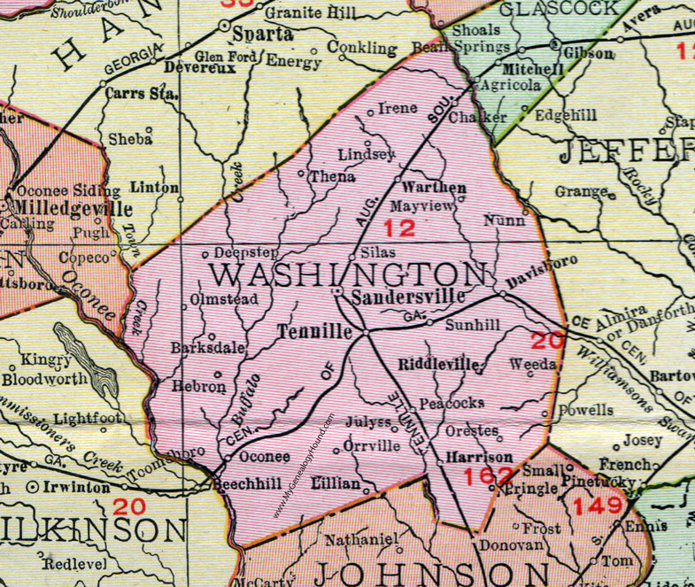
Washington County, Georgia, 1911, Map

Locations shown include: Barksdale, Chalker, Davisboro, Deepstep, Harrison, Hebron, Irene, Julyss, Lillian, Lindsey, Mayview, Nunn, Oconee, Olmstead, Orestes, Orrville, Peacocks, Riddleville, Sandersville, Silas, Sunhill (Sun Hill), Tennille, Thena, Warthen, Weeda.
This Washington County map is a portion of a 1911 Georgia map by Rand McNally.
View additional Georgia Maps here: Georgia County Maps
County maps from other states can be viewed here: State County Maps
Use the links at the top right of this page to search or browse thousands of family biographies, historic maps and vintage photos.