My Genealogy Hound
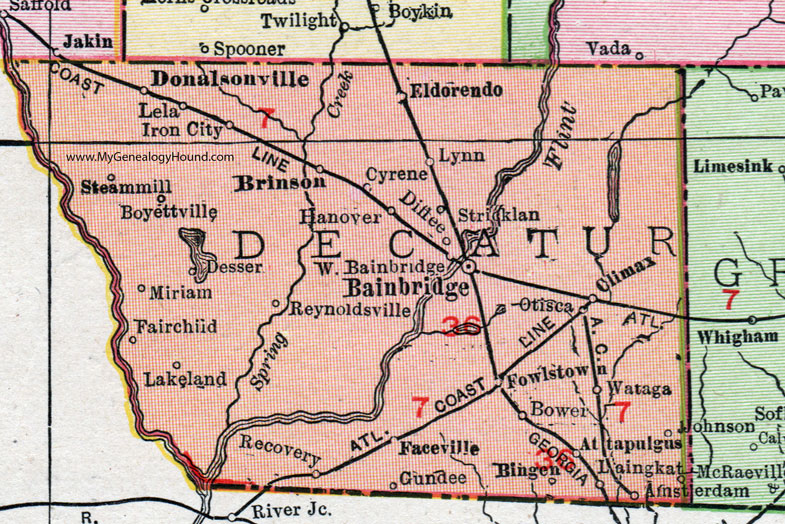
Decatur County, Georgia, 1911 Map

Locations shown include: Amsterdam, Attapulgus, Bainbridge, Bingen, Bower, Boyettville, Brinson, Climax, Cyrene, Desser, Diffee, Donalsonville, Eldorendo, Faceville, Fairchild, Fowlstown, Gundee, Hanover, Iron City, Laingkat, Lakeland, Lela, Lynn, Miriam, Otisca, Recovery, Reynoldsville, Steamville, Stricklan, Wataga, West Bainbridge.
This Decatur County map is a portion of a 1911 Georgia map by Rand McNally.
View additional Georgia Maps here: Georgia County Maps
County maps from other states can be viewed here: State County Maps
Use the links at the top right of this page to search or browse thousands of family biographies.