My Genealogy Hound
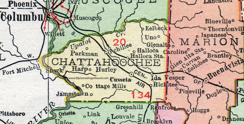
Chattahoochee County, Georgia, 1911 Map

Locations shown include: Cottage Mills, Cusseta, Eelbeck, Halloca, Halloca Station, Harp, Hichitee, Hurley, Ida, Jamestown, Ochillee, Parkman, Shack, Uno.
Fort Benning now occupies a large portion of northern and western Chattahoochee County.
This Chattahoochee County map is a portion of a 1911 Georgia map by Rand McNally.
View additional Georgia Maps here: Georgia County Maps
County maps from other states can be viewed here: State County Maps
Use the links at the top right of this page to search or browse thousands of family biographies.