My Genealogy Hound
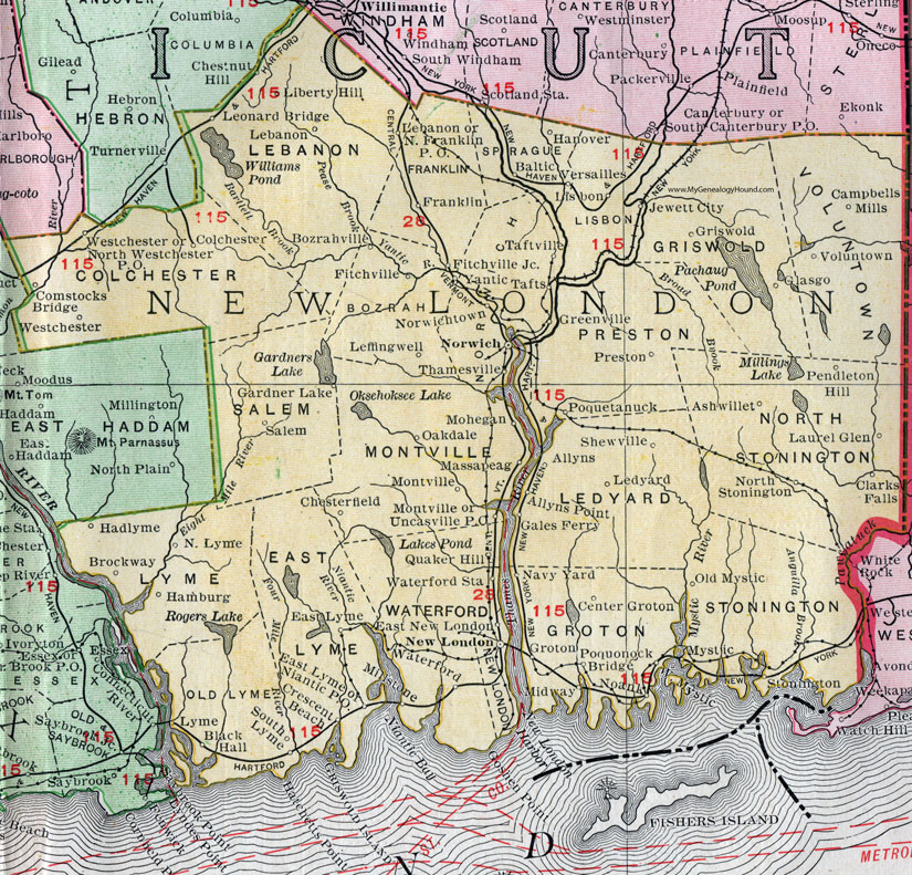
New London County, Connecticut, 1911 Map

Locations shown include: Allyns, Allyns Point, Ashwillet, Baltic, Black Hall, Bozrahville, Brockway, Campbells Mills, Center Groton, Clarks Falls, Colchester, Comstocks Bridge, Crescent Beach, East Lyme, East New London, Fitchville, Fitchville Junction, Franklin, Gales Ferry, Gardner Lake, Glasgo, Greenville, Griswold, Groton, Hadlyme, Hamburg, Hanover, Jewett City, Laurel Glen, Lebanon, Ledyard, Leffingwell, Leonard Bridge, Liberty Hill, Lisbon, Lyme, Massapeag, Millstone, Mohegan, Montville, Mystic, Navy Yard, New London, Niantic P O, Noank, North Franklin P O, North Lyme, North Stonington, North Westchester P O, Norwich, Norwichtown, Oakdale, Old Mystic, Pendleton Hill, Poquetanuck, Poquonock Bridge, Preston, Quaker Hill, Salem, Shewville, South Lyme, Stonington, Tafts, Taftville, Thamesville, Uncasville P O, Versailles, Voluntown, Waterford, Waterford Station, Westchester, West Mystic, Yantic.
This New London County map is a portion of a 1911 Connecticut map by Rand McNally.
View additional Connecticut Maps here: Connecticut County Maps
County maps from other states can be viewed here: State County Maps
Use the links at the top right of this page to search or browse thousands of family biographies.