My Genealogy Hound
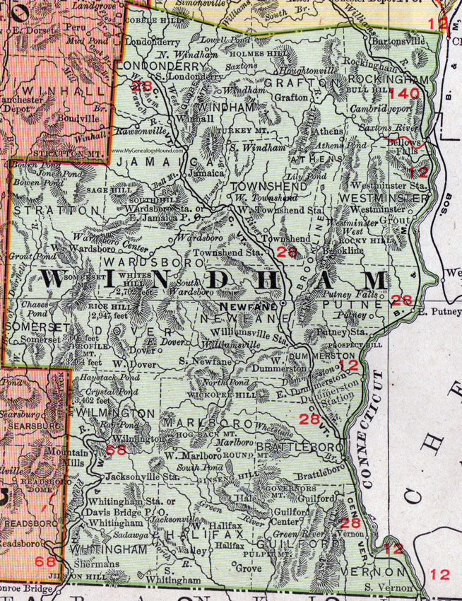
Windham County, Vermont 1911 Map

Locations shown include: Athens, Bartonsville, Bellows Falls, Brattleboro, Brookline, Cambridgeport, Davis Bridge P O, Dover, Dummerston, Dummerston Station, East Dover, East Dummerston, East Jamaica P O, East Putney, Grafton, Grout, Grove, Guilford, Guilford Center, Hale, Halifax, Houghtonville, Jacksonville, Jacksonville Station, Jamaica, Londonderry, Marlboro, Newfane, North Windham, Putney, Putney Falls, Putney Station, Rawsonville, Rockingham, Saxtons River, Shermans, South Newfane, South Londonderry, South Vernon, South Wardsboro, South Whitingham, South Windham, Townshend, Townshend Station, Valley, Vernon, Wardsboro, Wardsboro Center, Wardsboro Station, Westminster, Westminster Station, Westminster West, West Dover, West Dummerston, West Halifax, West Marlboro, West Townshend, West Townshend Station, West Wardsboro, Whitingham, Whitingham Station, Williamsville, Williamsville Station, Wilmington, Windham, Winhall.
This Windham County map is a portion of a 1911 Vermont map by Rand McNally.
View additional Vermont Maps here: Vermont County Maps
County maps from other states can be viewed here: State County Maps
Use the links at the top right of this page to search or browse thousands of family biographies.