My Genealogy Hound
Robertson County, Tennessee 1888 Map
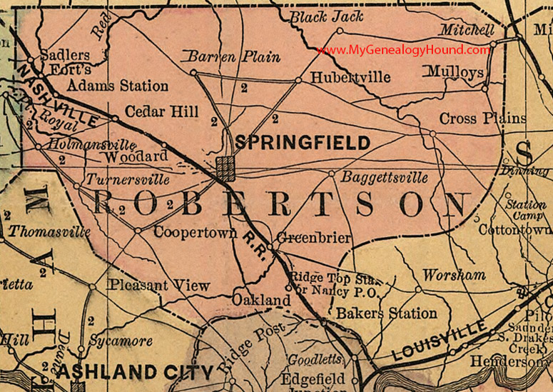
Locations shown include: Adams Station, Baggettsville, Barren Plain, Black Jack, Cedar Hill, Coopertown, Cross Plains, Forts, Greenbrier, Holmansville, Hubertville, Mitchell, Mulloys, Nancy, Oakland, Ridge Top Station, Sadlers, Springfield, Turnersville, Woodard
This a portion of a Tennessee map by Rand, McNally & Co. 1882, 1888
View additional Tennessee Maps here: Tennessee County Maps
County maps from other states can be viewed here: State County Maps
Additional Robertson County resources: Robertson County, Tennessee History and Genealogy
Use the links at the top right of this page to search or browse thousands of family biographies.