My Genealogy Hound
Meigs County, Tennessee 1888 Map
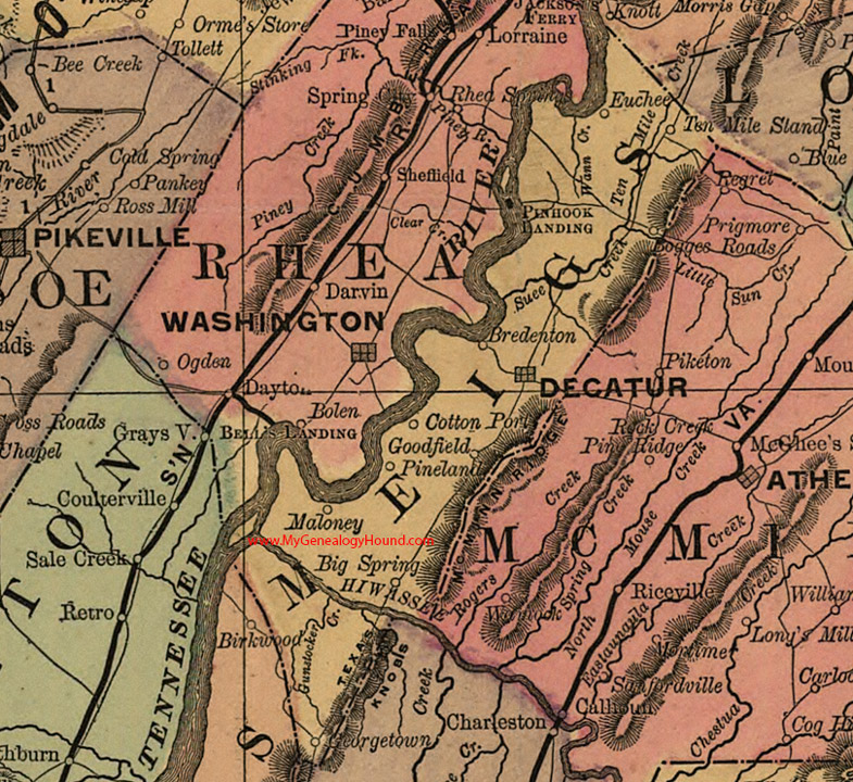
Locations shown include: Big Spring, Bogges Roads (Boggess Crossroad), Bredenton, Cotton Port, Decatur, Euchee, Georgetown, Goodfield, Maloney, Pineland, Pinhook Landing, Ten Mile Stand
This a portion of a Tennessee map by Rand, McNally & Co. 1882, 1888
View additional Tennessee Maps here: Tennessee County Maps
County maps from other states can be viewed here: State County Maps
Additional Meigs County resources: Meigs County, Tennessee History and Genealogy
Use the links at the top right of this page to search or browse thousands of family biographies.