My Genealogy Hound
Maury County, Tennessee 1888 Map
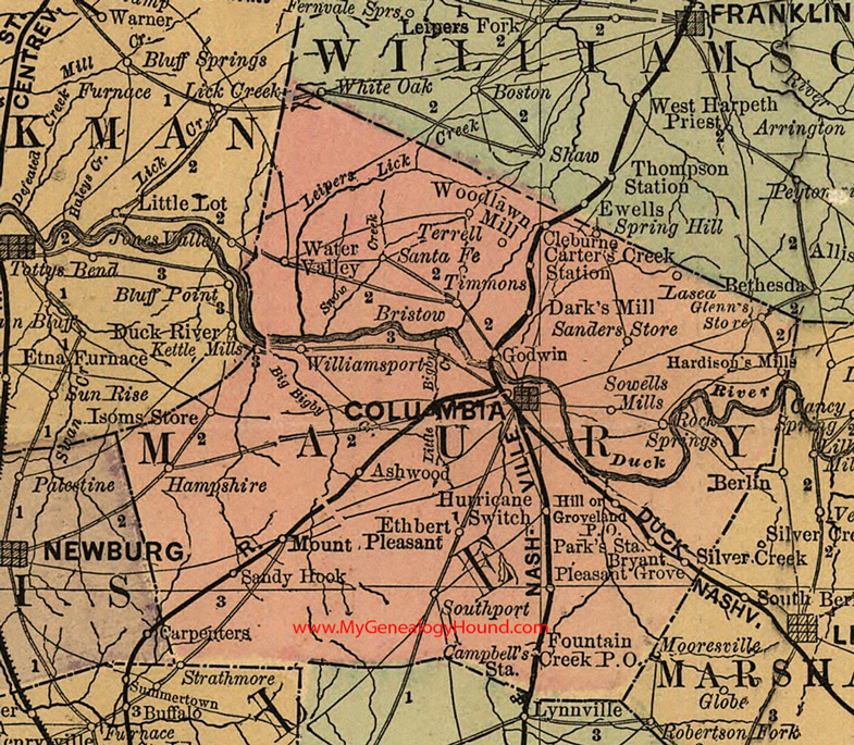
Locations shown include: Ashwood, Bristow, Bryant, Campbell's Station, Carter's Creek Station, Cleburne, Columbia, Dark's Mill, Ethbert, Fountain Creek, Glenn's Store, Godwin, Groveland, Hampshire, Hardison's Mills, Hill, Hurricane Switch, Kettle Mills, Lasea, Mount Pleasant, Park's Station, Pleasant Grove, Rock Springs, Sanders Store, Sandy Hook, Santa Fe, Southport, Sowells Mills, Spring Hill, Strathmore, Terrell, Timmons, Water Valley, Williamsport, Woodlawn Mill
This a portion of a Tennessee map by Rand, McNally & Co. 1882, 1888
View additional Tennessee Maps here: Tennessee County Maps
County maps from other states can be viewed here: State County Maps
Use the links at the top right of this page to search or browse thousands of family biographies.