My Genealogy Hound
Decatur County, Tennessee 1888 Map
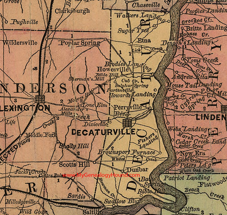
Locations shown include: Bath Springs, Bible Hill (two locations), Brodies Landing, Brownsport Furnace, Decaturville, Dunbar, Etna, Fishers Landing, Howards Landing, Howesville, Lick Creek, Partinville, Perryville, Sugar Tree, Sulphur Springs, Swallow Bluff, Walkers Landing
This a portion of a Tennessee map by Rand, McNally & Co. 1882, 1888
View additional Tennessee Maps here: Tennessee County Maps
County maps from other states can be viewed here: State County Maps
Additional Decatur County resources: Decatur County, Tennessee History and Genealogy
Use the links at the top right of this page to search or browse thousands of family biographies.