My Genealogy Hound
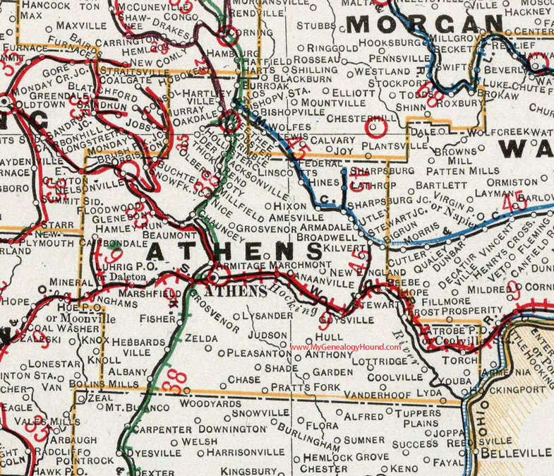
Athens County, Ohio 1901 Map

Locations shown include: Albany * Amesville * Anthony * Armadale * Armitage * Ashtabula * Ashtabula Station * Athens * Beaumont * Bigrun * Bishopville Station * Broadwell * Buchtel * Burr Oak * Canaanville * Carbondale * Chase * Chauncey * Coolville * Daleton * Derthick * Doty * Federal * Fisher * Floodwood * Frost * Garden * Glenebon * Glouster * Grosvenor * Guysville * Hamley Run * Hartleyville * Hebbardsville * Hines * Hixon * Hollister * Hull * Inghams * Jacksonville * Judson * Kilvert * Lathrop * Latrobe P O * Linscotts * Lottridge * Luhrig P O * Lyda * Lysander * Marchmont * Millfield * Nelsonville * New England * Nice * Oakdale * Olbers * Palos * Pleasanton * Pratts Fork * Rend * Shade * Sharpsburg * Sharpsburg Jct. * Snowflake Jct. * Stewart * Stewart Jct. * Torch * Trimble * Utley * Vanderhoof * Weethee * Youba * Zelda
This Athens County map is a portion of an 1901 Ohio map by Cram.
View additional Ohio Maps here: Ohio County Maps
County maps from other states can be viewed here: State County Maps
Use the links at the top right of this page to search or browse thousands of family biographies.