My Genealogy Hound
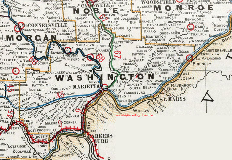
Washington County, Ohio 1901 Map

Locations shown include: Archers Fork * Armenia * Barlow * Bartlett * Belpre * Bevan * Beverly * Browns Mill * Canfield Road * Carter * Caywood * Churchtown * Coal Run * Constitution * Corner * Cow Run * Cutler * Dale * Dalzell * Dawes * Decaturville * Dell * Deucher * Devola * Dunbar * Dunham * Dye * Elba * Equity * Fay * Fifteen * Fillmore * Fleming * Flints Mill * Gasville * Glass * Gracey * Gravel Bank * Hayward * Henrys Crossing * Heslop * Hills * Hohman * Hope * Lawrence * Layman * Leith * Little Hocking * Lowell * Lower Newport * Lower Salem * Luke Chute * Lundville * Macksburg * Marietta * McAvan * Mildred * Moores Junction * Morris * Moss Run * Muskingum * Napier * Netop * Newell Run * New Matamoras * Newport * Ormiston * Patten Mills * Pool * Porterfield * Prosperity * Qualey * Rainbow * Relief * Reno * Riggs * Rockland * Saltpetre * Scotts Landing * Sitka * Stanleyville * Steel Run * Tunnel * Vet * Vincent * Virginia P O * Yankeeburg * Wade * Warner * Waterford * Watertown * West Grandview * Whipple * Wingett Run * Wolf Creek *
This Washington County map is a portion of an 1901 Ohio map by Cram.
View additional Ohio Maps here: Ohio County Maps
County maps from other states can be viewed here: State County Maps
Use the links at the top right of this page to search or browse thousands of family biographies.