My Genealogy Hound
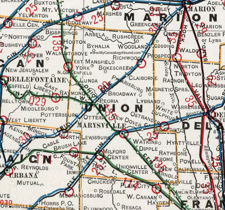
Union County, Ohio 1901 Map

Locations shown include: Arbela * Arnold * Bokescreek * Broadway * Byhalia * Chuckery * Claiborne * Dipple * Irwin * Jerome * Lunda * Magnetic Springs * Marysville * Milford Center * New Dover * Otter * Peoria * Pharisburg * Pottersburg * Raymond * Richwood * Rush Creek * Unionville Center * Watkins * West Mansfield * York *
This Union County map is a portion of an 1901 Ohio map by Cram.
View additional Ohio Maps here: Ohio County Maps
County maps from other states can be viewed here: State County Maps
Use the links at the top right of this page to search or browse thousands of family biographies.