My Genealogy Hound
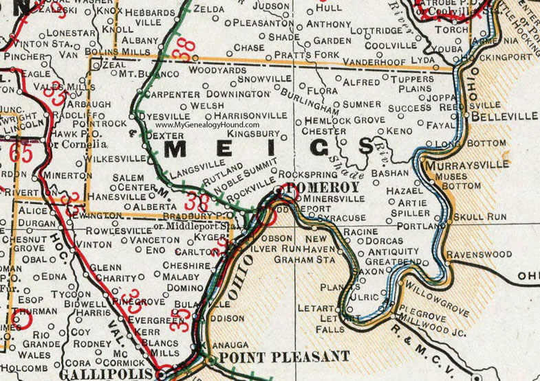
Meigs County, Ohio 1901 Map

Locations shown include: Alberta * Alfred * Antiquity * Apple Grove * Artie * Bashan * Bradbury P O * Burlingham * Carpenter * Chester * Dexter * Dorcas * Downington * Dyesville * Fayal * Flora * Graham Station * Great Bend * Hanesville * Harrisonville * Hazael * Hemlock Grove * Hobson * Joppa * Keno * Kingsbury * Langsville * Letart * Letart Falls * Long Bottom * Middleport * Middleport Station * Millwood Junction * Minersville * Mount Blanco * New Haven * Noble Summit * Plants * Pomeroy * Portland * Racine * Reedsville * Rock Springs * Rockville * Rutland * Salem Center * Saxon * Silver Run * Snowville * Spiller * Success * Syracuse * Tuppers Plains * Ulric * Welsh * Willow Grove * Zeal *
This Meigs County map is a portion of an 1901 Ohio map by Cram.
View additional Ohio Maps here: Ohio County Maps
County maps from other states can be viewed here: State County Maps
Use the links at the top right of this page to search or browse thousands of family biographies.