My Genealogy Hound
Taney County, Missouri 1904 Map
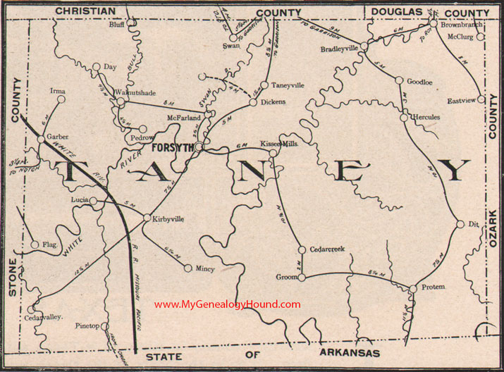
Locations shown include: Bluff, Bradleyville, Brownbranch, Cedar Creek, Cedar Valley, Day, Dickens, Dit, Eastview, Flag, Forsyth, Garber, Goodloe, Groom, Hercules, Irma, Kirbyville, Kissee Mills, Lucia, McClurg, McFarland, Mincy, Pedrow, Pinetop, Protem, Swan, Taneyville, Walnut Shade
View additional Missouri Maps here: Missouri County Maps
County maps from other states can be viewed here: State County Maps
Additional Taney County resources: A Reminiscent History of The Ozark Region
Use the links at the top right of this page to search or browse thousands of family biographies.