My Genealogy Hound
Putnam County, Missouri 1904 Map
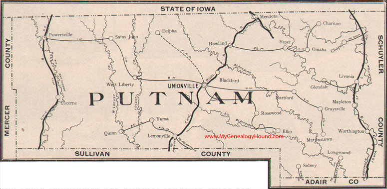
Locations shown include: Blackbird, Chapel, Chariton, Delpha, Elko, Esper, Glendale, Graysville, Hartford, Howland, Lemonville (Lemons), Livonia, Low Ground, Lucerne, Mapleton, Martinsville, Mendota, Omaha, Powersville, Quinn, Rosewood, Saint John, Sidney, Unionville, West Liberty, Worthington, Yuma
View family biographies from the 1888 History of Putnam County, Missouri
View additional Missouri Maps here: Missouri County Maps
County maps from other states can be viewed here: State County Maps
Additional Putnam County resources: Putnam County, Missouri History, Genealogy, and Maps
Use the links at the top right of this page to search or browse thousands of family biographies.