My Genealogy Hound
McDonald County, Missouri 1861 Map
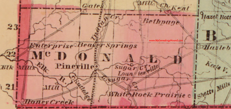
Locations shown include: Beaver Springs, Bethpage, Elk Mills, Enterprise, Honey Creek, Louniesville, Pineville, Shetts Mills, White Rock Prairie
This map is a portion of a Missouri map by J. T. Lloyd, 1861
View additional McDonald County, Missouri Maps here
View family biographies from the 1888 History of McDonald County: McDonald County, Missouri
View additional Missouri Maps here: Missouri County Maps
County maps from other states can be viewed here: State County Maps
Additional McDonald County resources: McDonald County, Missouri History, Genealogy, and Maps
Use the links at the top right of this page to search or browse thousands of family biographies.