My Genealogy Hound
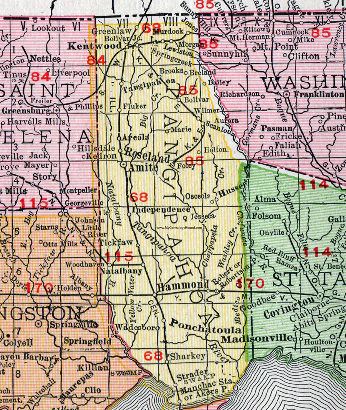
Tangipahoa Parish, Louisiana 1911 Map

Locations shown include: Akers P O, Amite, Arcola, Bailey, Bolivar, Bolivar Junction, Breland, Brooks, Fluker, Foley, Greenlaw, Hammond, Holton, Husser, Independence, Jessea, Kentwood, Lewiston, Manchac Station, Marie, Morgan, Murdock, Natalbany, Osceola, Ponchatoula, Robert, Robertson P O, Roseland, Scanlon, Sharkey, Springcreek (Spring Creek), Strader, Tangipahoa, Tickfaw, Wadesboro, Wilmer, Woodhaven.
This Tangipahoa Parish map is a portion of a 1911 Louisiana map by Rand McNally.
View additional Louisiana Maps here: Louisiana Parish Maps
County maps from other states can be viewed here: State County Maps
Use the links at the top right of this page to search or browse thousands of family biographies.