My Genealogy Hound
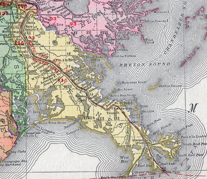
Plaquemines Parish, Louisiana 1911 Map

Locations shown include: Belair, Belle Chasse, Bertrandville, Buras, City Price P O, Concession, Crown Point, Daisy, Dalcour P O, Diamond, Dime, Empire, English Turn, Fanny, Fort Jackson, Fort Livingston, Fort Saint Philip, Grand Bayou, Happy Jack, Homeplace, Jesuit Bend, Junior, La Reussitte, Lawrence P O, Magnolia, Mary, Metcalf, Myrtlegrove (Myrtle Grove), Nairn, Naomi, Neptune, Nero, Nestor, Nichols, Oakville, Olga, Orange Farm, Ostrica, Phoenix, Pilottown, Pointe a La Hache, Point Celeste, Port Eads, Potash, Quarantine, Saint Clair, Saint Rosalie, Socola, Star, Stella, Sunrise, Triumph, Venice, West Pointe a La Hache, Wood Park.
This Plaquemines Parish map is a portion of a 1911 Louisiana map by Rand McNally.
View additional Louisiana Maps here: Louisiana Parish Maps
County maps from other states can be viewed here: State County Maps
Use the links at the top right of this page to search or browse thousands of family biographies.