My Genealogy Hound
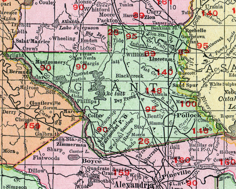
Grant Parish, Louisiana 1911 Map

Locations shown include: Aloha, Antonia, Bentley (Bently), Bills, Blackcreek, Bob, Clear Creek, Colfax, Conrad, Denkman Junction, Dry Prong, Fairmount P O, Georgetown, Grant, Hadnot, Hargis, Howcott, Iatt, Junction, Kateland, Lincecum, Manistee, Montgomery, Morris, New Verda, Phillips, Pollock, Ravencamp, Redemption, Rochelle, Sand Spur, Santiago, Selma, Simms, Stay, Stolz, Tide, Tully, Verda, Werdohl, Wetzlar, William, Zion Station.
This Grant Parish map is a portion of a 1911 Louisiana map by Rand McNally.
View additional Louisiana Maps here: Louisiana Parish Maps
County maps from other states can be viewed here: State County Maps
Use the links at the top right of this page to search or browse thousands of family biographies.