My Genealogy Hound
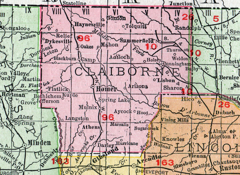
Claiborne Parish, Louisiana 1911 Map

Locations shown include: Antioch, Arizona, Athens, Aycock, Blackburn, Camp, Cunningham, Darley, Dykesville, Flatlick, Gordon, Haynesville, Holsey, Homer, Hood, Hurricane, Langston, Lisbon, Mahon, Marsalis, Mulnix, Oaks, Relief, Ruple, Sharon, Spring Lake, Sugarcreek (Sugar Creek), Summerfield, Thurmon, Tolquitt, Weldon.
This Claiborne Parish map is a portion of a 1911 Louisiana map by Rand McNally.
View additional Louisiana Maps here: Louisiana Parish Maps
County maps from other states can be viewed here: State County Maps
Use the links at the top right of this page to search or browse thousands of family biographies.