My Genealogy Hound
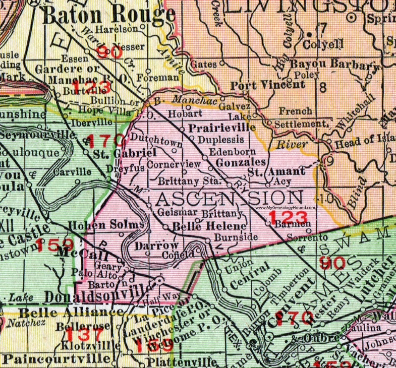
Ascension Parish, Louisiana 1911 Map

Locations shown include: Acy, Barmen, Barton, Bele Helene, Belle Helene, Brittany, Brittany Station, Bullion, Burnside, Cofield, Cornerview, Darrow, Donaldsonville, Duplessis, Dutchtown, Edenborn, Galvez Lake, Geary, Geismar, Gonzales, Half Way, Hobart, Hohen Solms, Hope Villa P O, Manchac, McCall, Palo Alto, Prairieville, Saint Amant, Sorrento.
This Ascension Parish map is a portion of a 1911 Louisiana map by Rand McNally.
View additional Louisiana Maps here: Louisiana Parish Maps
County maps from other states can be viewed here: State County Maps
Use the links at the top right of this page to search or browse thousands of family biographies.