My Genealogy Hound
Hopkins County, Kentucky 1905 Map
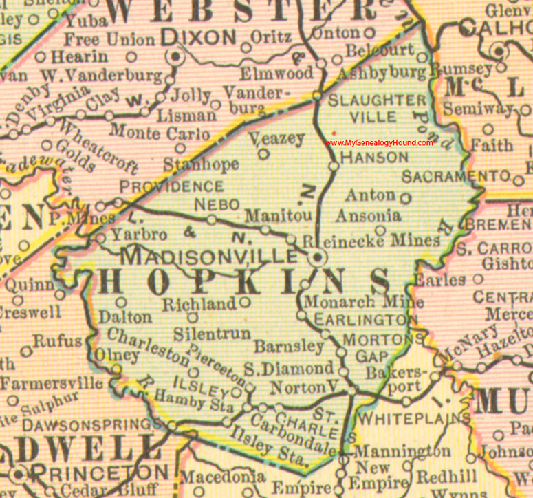
Locations shown include: Ansonia, Anton, Ashbyburg, Barnsley, Carbondale, Charleston, Dalton, Dawson Springs, Earlington, Hamby Station, Hanson, Isley, Isley Station, Madisonville, Manitou, Monarch Mine, Mortons Gap, Nebo, Nortonville, Olney, Pierceton, Reinecke Mines, Richland, St. Charles, Silentrun, South Diamond, Veazey, Yarbo
This a portion of a Kentucky map from Cram's Ideal Reference Atlas, 1905
View additional Kentucky Maps here: Kentucky County Maps
County maps from other states can be viewed here: State County Maps
Additional Hopkins County resources: Hopkins County, Kentucky History and Genealogy
Use the links at the top right of this page to search or browse thousands of family biographies.