My Genealogy Hound
Grant County, Kentucky 1905 Map
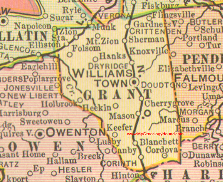
Locations shown include: Blanchet (Blanchett), Cherry Grove, Cordova, Corinth, Crittenden, Dry Ridge, Elliston, Flingsville, Folsom, Hanks, Heekin, Holbrook, Keefer, Mason, Mt. Zion, Sherman, Williamstown, Zion Station
This a portion of a Kentucky map from Cram's Ideal Reference Atlas, 1905
View additional Kentucky Maps here: Kentucky County Maps
County maps from other states can be viewed here: State County Maps
Additional Grant County resources: Grant County, Kentucky History and Genealogy
Use the links at the top right of this page to search or browse thousands of family biographies.