My Genealogy Hound
Anderson County, Kentucky 1905 Map
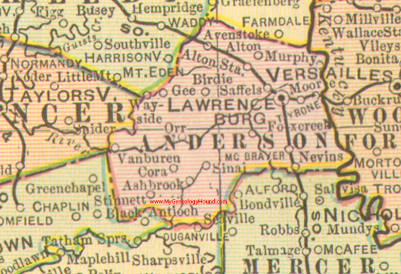
Locations shown include: Alton, Alton Station, Ashbrook, Avenstoke, Birdie, Cora, Fox Creek, Gee, Lawrenceburg, McBrayer, Moore, Murphy, Nevins, Orr, Saffels, Sinai, Stinnett, Tyrone, Van Buren, Wayside
This a portion of a Kentucky map from Cram's Ideal Reference Atlas, 1905
View additional Kentucky Maps here: Kentucky County Maps
County maps from other states can be viewed here: State County Maps
Additional Anderson County resources: Anderson County, Kentucky History and Genealogy
Use the links at the top right of this page to search or browse thousands of family biographies.