My Genealogy Hound
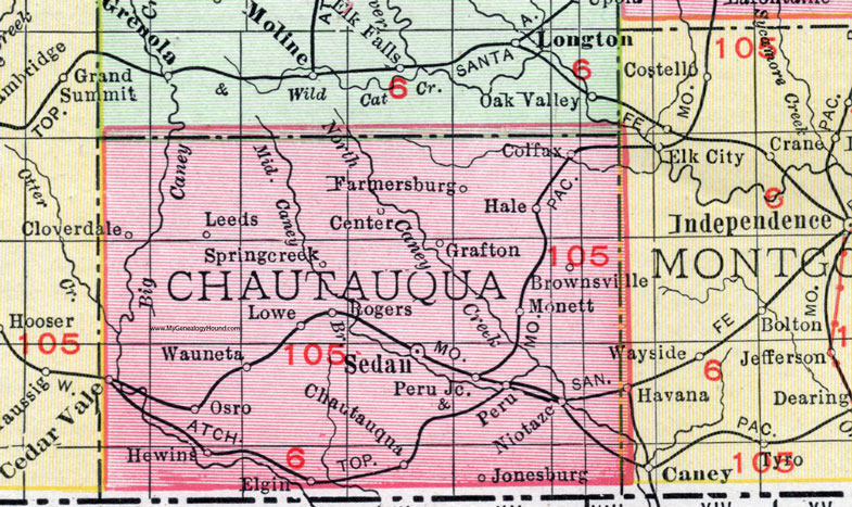
Chautauqua County, Kansas 1911 Map

Locations shown include: Brownsville, Cedar Vale, Center, Chautauqua, Cloverdale, Colfax, Elgin, Farmersburg, Grafton, Hale, Hewins, Jonesburg, Leeds, Lowe, Monett, Niotaze, Osro, Peru, Peru Junction, Rogers, Sedan, Springcreek, Wauneta.
This Chautauqua County map is a portion of a 1911 Kansas map by Rand McNally.
View additional Kansas County Maps here: Kansas County Maps
County maps from other states can be viewed here: State County Maps
Use the links at the top right of this page to search or browse thousands of family biographies, historic maps, vintage photos and postcards.