My Genealogy Hound
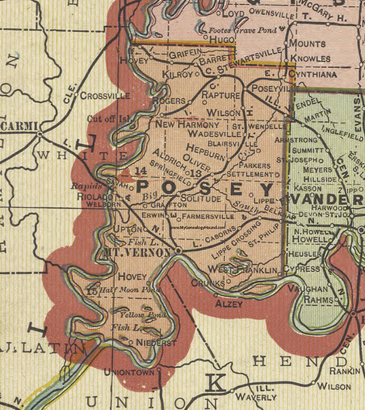
Posey County, Indiana 1908 Map

Locations shown include: Aldrich, Alzey, Barrett, Blairsville, Caborns, Crunks, Cynthiana, Erwin, Farmersville, Grafton, Griffin, Hepburn, Hovey, Kilroy, Lippe, Lippe Crossing, Mt. Vernon, New Harmony, Niederst, Oliver, Parkers Settlement, Poseyville, Rapture, Riolado, Rogers, St. Philip, St. Wendells, Savah, Solitude, Springfield, Stewartsville, Upton, Wadesville, Wellborn, Wendel, West Franklin
This a portion of a map by Geo. A. Ogle & Co., 1908
View additional Indiana Maps: Indiana County Maps
County maps from other states can be viewed here: State County Maps
Additional Posey County resources: Posey County, Indiana History and Genealogy
Use the links at the top right of this page to search or browse thousands of family biographies.