My Genealogy Hound
Jo Daviess County, Illinois 1870 Map
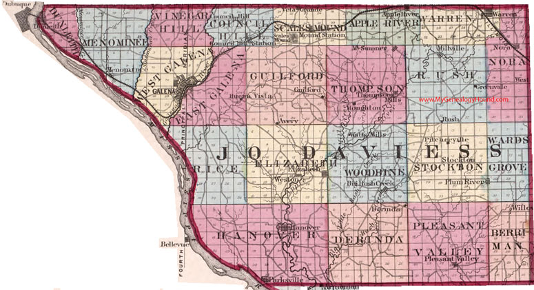
Locations shown include: Apple River, Avery, Big Rush Creek, Council Hill, Council Hill Station, Derinda, Dunleith, Elizabeth, Galena, Guilford, Greenvale, Hanover, Houghton, Menominee, Millville, Mt. Sumner, Nora, Parksville, Pitcherville, Pleasant Valley, Plum River, Scales Mound, Stockton, Thompsons Mills, Veta Grande, Warren, Watts Mills, Weston, Willow
The names shown in all caps are the names of the townships
This a portion of a map from Atlas of Illinois, by Warner & Beers, 1870
View additional Illinois Maps here: Illinois County Maps
County maps from other states can be viewed here: State County Maps
Use the links at the top right of this page to search or browse thousands of family biographies.