My Genealogy Hound
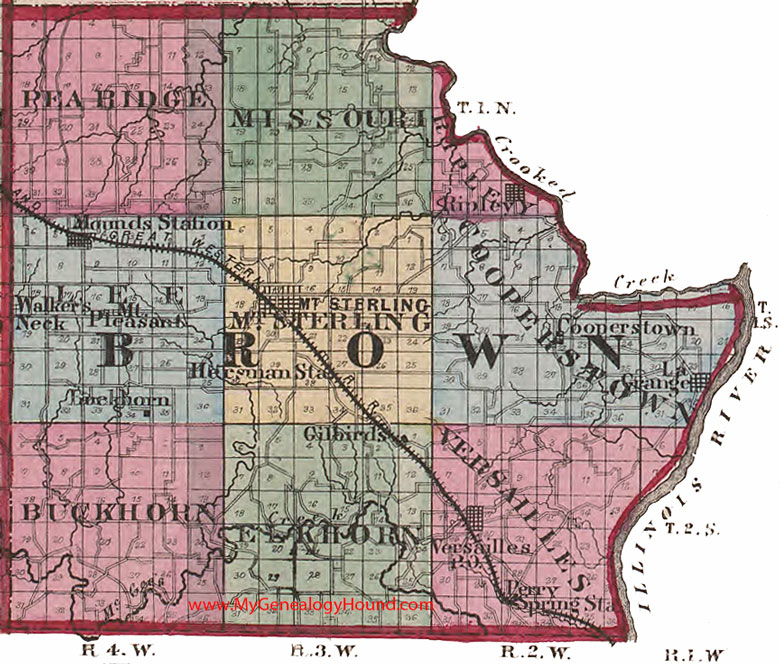
Brown County, Illinois 1870 Map

Locations shown include: Buckhorn, Cooperstown, Gilbirds, Hersman Station, La Grange, Mounds Station, Mt. Pleasant, Mt. Sterling, Perry Spring Station, Ripley, Versailles, Walker's Neck
The names shown in all caps are the names of the townships
This a portion of a map from Atlas of Illinois, by Warner & Beers, 1870
View additional Illinois Maps here: Illinois County Maps
County maps from other states can be viewed here: State County Maps
Use the links at the top right of this page to search or browse thousands of family biographies.