My Genealogy Hound
St. Francis County, Arkansas 1889 Map
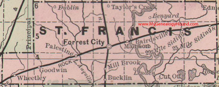
Locations shown include: 25 Mile Siding, 29 Mile Siding, Bairdsville, Benyard, Bucklin, Dublin, Forrest City, Goodwin, Linden, Madison, Mill Brook, Palestine, Taylor's Creek, Wheatley (Wheetley)
This is a portion of a Arkansas map published by Bradley, circa 1889.
View family biographies from the 1890 History of St. Francis County, Arkansas: St. Francis County, Arkansas
View additional Arkansas Maps here: Arkansas County Maps
County maps from other states can be viewed here: State County Maps
Additional St. Francis County resources: St. Francis County, Arkansas History, Genealogy, and Maps
Use the links at the top right of this page to search or browse thousands of family biographies.