My Genealogy Hound
Searcy County, Arkansas 1889 Map
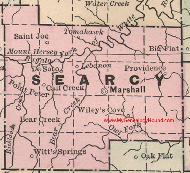
Locations shown include: Bear Creek, Calf Creek, DeSoto, Lebanon, Marshall, Point Peter, Providence, Saint Joe, Tomahawk, Wiley's Cove, Witt's Springs
This is a portion of a Arkansas map published by Bradley, circa 1889.
View additional Arkansas Maps here: Arkansas County Maps
County maps from other states can be viewed here: State County Maps
Additional Searcy County resources: A Reminiscent History of The Ozark Region
Use the links at the top right of this page to search or browse thousands of family biographies.