My Genealogy Hound
Saline County, Arkansas 1909 Map
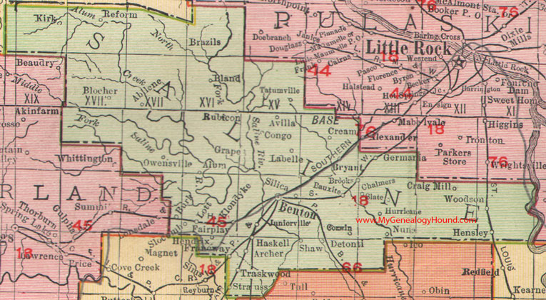
Locations shown include: Abilene, Alum, Archer, Avilla, Bauxite, Benton, Bland, Blocher, Brazils, Brooks, Bryant, Burk, Chalmers, Congo, Corwin, Craig Mill, Cream, Fairplay, Francway, Germania, Grape, Haskell, Hendrix, Hensley, Hurricane, Juniorville, Kirk, Klondyke, Labelle, Lott, Nuna, Owensville, Reform, Rubicon, Silica, Slate, Slocomb, Strauss, Tatumville, Traskwood, Woodson
The large red numbers identify railroad lines:
18: Chicago, Rock Island & Pacific Railroad
45: Little Rock & Hot Springs Western Railroad
66: Pine Bluff & Western Railroad
76: St. Louis, Iron Mountain & Southern Railroad
This is a portion of a Arkansas map published by Rand McNally & Co., 1902, 1909.
View family biographies from the 1889 History of Saline County: Saline County, Arkansas
View additional Arkansas Maps here: Arkansas County Maps
County maps from other states can be viewed here: State County Maps
Additional Saline County resources: Saline County, Arkansas History, Genealogy, and Maps
Use the links at the top right of this page to search or browse thousands of family biographies.