My Genealogy Hound
Johnson County, Arkansas 1889 Map
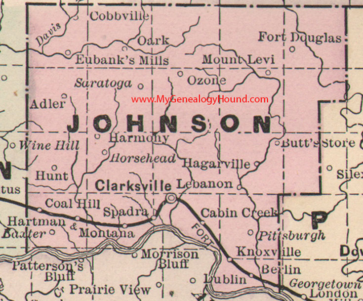
Locations shown include: Adler, Baxter, Berlin, Butt's Store, Cabin Creek, Clarksville, Coal Hill, Cobbville, Eubank's Mills, Fort Douglas, Hagarville, Harmony, Hartman, Horsehead, Hunt, Knoxville, Lebanon, Montana, Mount Levi, Oark, Ozone, Pittsburgh, Saratoga, Spadra
This is a portion of a Arkansas map published by Bradley, circa 1889.
View family biographies from the 1891 History of Johnson County, Arkansas: Johnson County, Arkansas
View additional Arkansas Maps here: Arkansas County Maps
County maps from other states can be viewed here: State County Maps
Additional Johnson County resources: Johnson County, Arkansas History, Genealogy, and Maps
Use the links at the top right of this page to search or browse thousands of family biographies.