My Genealogy Hound
Independence County, Arkansas 1889 Map
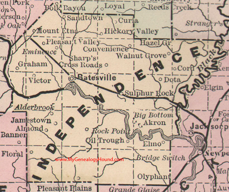
Locations shown include: Akron, Alderbrook, Almond, Batesville, Big Bottom, Convenience, Cord, Curia, Dota, Elmo, Eminence, Floral, Graham, Hickory Valley, Jamestown, Mount Etna, Oil Trough, Pleasant Plains, Pleasant Valley, Polk Bayou, Rock Point, Sandtown, Sharp's Cross Roads, Sulphur Rock, Victor, Walnut Grove
This is a portion of a Arkansas map published by Bradley, circa 1889.
View additional Arkansas Maps here: Arkansas County Maps
County maps from other states can be viewed here: State County Maps
Additional Independence County resources: Independence County, Arkansas History, Genealogy, and Maps
Use the links at the top right of this page to search or browse thousands of family biographies.