My Genealogy Hound
Benton County, Arkansas 1876 Map
View additional Benton County Maps here: Benton County, Arkansas Maps
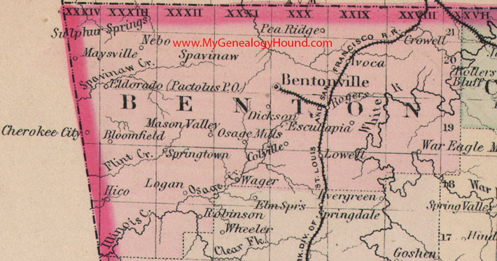
Locations shown include: Avoca, Bentonville, Bloomfield, Cherokee City, Colville, Crowell, Dickson, Eldorado, Esculapia, Hico, Logan, Lowell, Mason Valley, Maysville, Nebo, Osage Mills, Pactolus, Pea Ridge, Robinson, Rogers, Rollers Bluff, Spavinaw, Springtown, Sulphur Springs, Wager, War Eagle Mills
This is a portion of a Arkansas map published by O. W Gray and Son. Although the map is dated 1876, it was actually published no earlier than 1883.
View family biographies from the 1889 History of Benton County: Benton County, Arkansas
View additional Benton County Maps here: Benton County, Arkansas Maps
View additional Arkansas Maps here: Arkansas County Maps
County maps from other states can be viewed here: State County Maps
Additional Benton County resources: Benton County, Arkansas History, Genealogy, and Maps
Use the links at the top right of this page to search or browse thousands of family biographies.