My Genealogy Hound
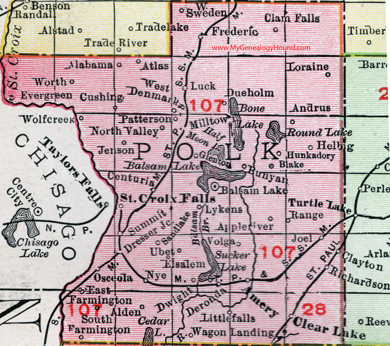
Polk County, Wisconsin, 1912 Map

Locations shown include: Alabama, Amery, Andrus, Appleriver (Apple River), Atlas, Balsam Lake, Blake, Bunyan, Centuria, Clam Falls, Clayton, Clear Lake, Cushing, Deronda, Dresser Junction, Dueholm, Dwight, East Farmington, Elsalem, Evergreen, Frederic, Glenton, Helbig, Hunkadory, Jenson, Joel, Littlefalls (Little Falls), Loraine, Luck, Lykens, Milltown, North Valley, Nye, Osceola, Patterson, Range, Richardson, St. Croix Falls, Sandlake (Sand Lake), South Farmington, Summit, Ubet, Volga, Wagon Landing, West Denmark, West Sweden, Wolfcreek, Worth.
This Polk County map is a portion of a 1912 map of Wisconsin by Rand McNally.
View additional Wisconsin Maps here: Wisconsin County Maps
County maps from other states can be viewed here: State County Maps
Use the links at the top right of this page to search or browse thousands of family biographies.