My Genealogy Hound
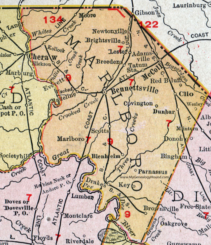
Marlboro County, South Carolina, 1911 Map

Locations shown include: Adamsville, Bennettsville, Blenheim, Breedens, Brightsville, Brownsville, Clio, Covington, Drakes, Dunbar, Everett, Hickson, Key, Kollock, Lester, Madeline, Marlboro, McColl, Moore, Newtonville, Parnassus, Red Bluff, Scotts, Tatum Station, Wesley.
This Marlboro County map is a portion of a 1911 South Carolina map by Rand McNally.
View additional South Carolina Maps here: South Carolina County Maps
County maps from other states can be viewed here: State County Maps
Use the links at the top right of this page to search or browse thousands of family biographies, historic photos and vintage postcards.