My Genealogy Hound
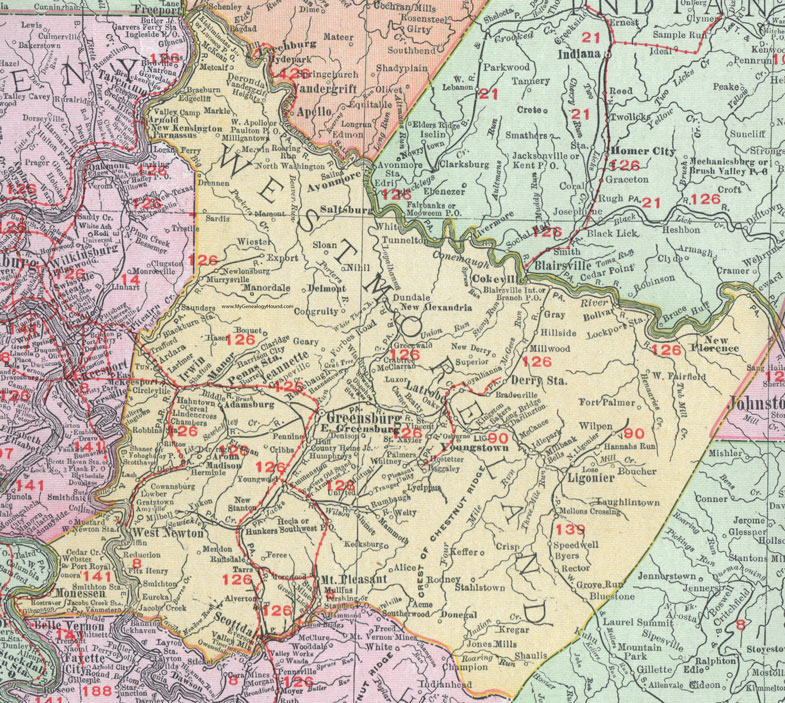
Westmoreland County, Pennsylvania 1911 Map

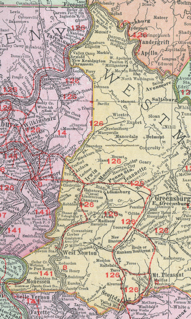
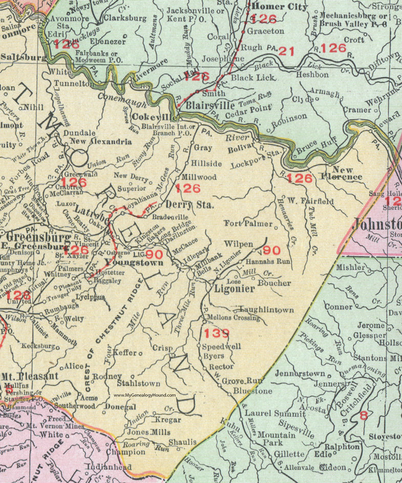
Locations shown include: Acme * Adamsburg * Alice * Alverton * Amyville * Ardara * Armbrust P O * Arnold * Arona * Avonmore * Baggaley * Bakers * Beatty * Bells * Biddle * Blackburn Station * Blairsville Int. * Bluestone * Bolivar * Boquet * Boucher * Bradenville * Braeburn * Branch P O * Burrell * Byers * Calumet * Carney * Cereal * Chambers * Circle Creek * Circleville * Claridge * Cokeville * Collinsburg * Congruity * County Home Junction * Cowansburg * Crabtree * Cribbs * Crisp * Darlington * Darragh * Delmont * Denison * Deronda * Derry Station * Dick * Donegal * Donohoe * Drennon * Dundale * East Greensburg * Edgecliff * Eisaman * Emmenston * Eureka * Everson * Export * Feree * Fitz Henry * Forbes Road * Fort Palmer * Geary * Georges Station * Gibsonton * Grapeville * Gratztown * Gray * Green Lick * Greensburg * Greenwald * Griffin * Grove Run * Hahntown * Hannahs Run * Hannastown * Harrison City * Haser * Hecla * Herminie * Hillside * Hostetter * Huff * Humphreys * Hunkers Southwest P O * Idlepark * Irwin * Jacobs Creek * Jacobs Creek Station * Jeannette * Jones Mills * Kecksburg * Keffer * Kingston * Kiskiminetas Junction * Kregar * Larimer * Lash * Latrobe * Laughlintown * Ligonier * Lindencross * Lockport Station * Long Bridge * Lose * Lowber * Loyalhanna * Lucesco P O * Luxor * Lycippus * Madison * Mammoth * Mamont * Manordale * Markle * McCance * McClarran * McKean * Mellons Crossing * Mendon * Merwin * Metcalf * Millbank * Milbell * Milligantown * Millwood * Monessen * Morewood * Mount Pleasant * Mullins * Murrysville * Mutual * New Alexandria * New Derry * New Florence * New Kensington * Newlonsburg * New Stanton * Nihil * North Ligonier * North Washington * Oakville * Osburne * Palmers * Parnassus * Paulton P O * Pennine * Penns Station * Pershing * Pleasant Unity * Port Royal * Pricedale * Radebaugh * Rector * Reduction * Rillton * Roaring Run * Robbins Station * Rodney * Rostraver * Ruffsdale (Ruffs Dale) * Rumbaugh * Saint vincent * Saint Xavier * Salina * Sardis * Saunders * Scottdale * Scotthaven (Scott Haven) * Shafton * Shaner * Shaulis * Sloan * Smithton * Smithton Station * Sowash * Speedwell * Stahlstown * Star Mines * Stauffer P O * Superior * Sutersville * Tarrs * Trafford * Trauger * United * Valley Camp * Vandergrift Heights * Vanmeter (Van Meter) * Weavers Old Stand * Webster * Welty * West Newton * West Newton Station * West Apollo * West Fairfield * Whitney * Wiester * Wilpen * Winthrop * Yohoghany P O * Youngstown * Youngwood * Yukon *
This Westmoreland County map is a portion of an 1911 Pennsylvania map by Rand McNally. See the enlarged map views below.

An enlarged view of western Westmoreland County, Pennsylvania on an 1911 map by Rand McNally.

An enlarged view of eastern Westmoreland County, Pennsylvania on an 1911 map by Rand McNally.
View additional Pennsylvania Maps here: Pennsylvania County Maps
County maps from other states can be viewed here: State County Maps
Use the links at the top right of this page to search or browse thousands of family biographies.