My Genealogy Hound
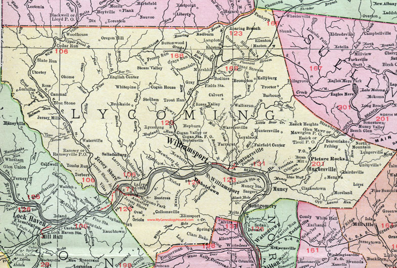
Lycoming County, Pennsylvania 1911 Map

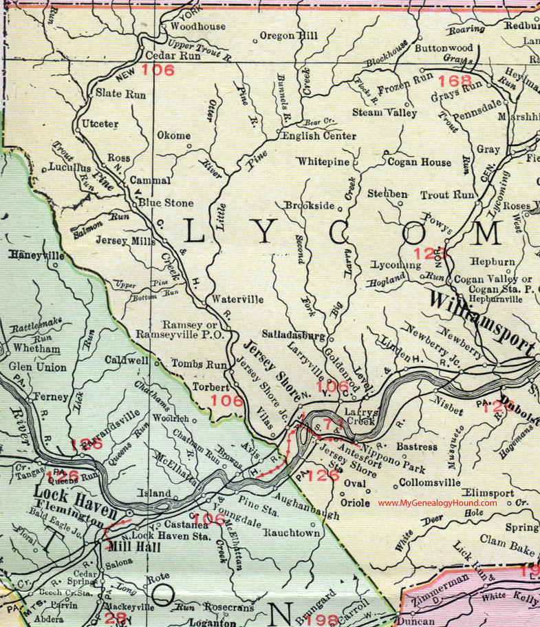
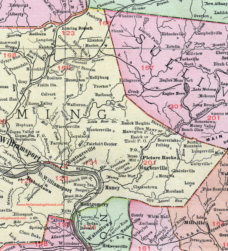
Locations shown include: Antesfort * Barbours * Bastress * Beaverlake (Beaver Lake) * Blue Stone * Bodines * Brompton * Brookside * Bryan Mill * Buttonwood * Calvert * Cammal * Cedar Run * Chippewa * Clarkstown * Cogan House * Cogan Station P O * Cogan Valley * Collomsville * Crandalltown * Duboistown * Elimsport * Ellenton * English Center * Essick * Essick Heights * Fairfield * Fairfield Ceneter * Farragut * Fields Station * Fribley * Frozen Run * Glen Mawr * Goldenrod * Gray * Grays Run * Halls * Hepburn * Hepburnville * Heylman * Hughesville * Jersey Mills * Jersey Shore * Jersey Shore Junction * Jersey Shore Station * Kellyburg * Lairdsville * Langdon * Larrys Creek * Larryville * Level * Lime Bluff * Linden * Long Siding * Lores * Loyalsock * Loyalsock Station * Lucullus * Lungerville * Lycoming * Marshhill (Marsh Hill) * Masten * Mawrglen P O * Mengwe * Montgomery * Montoursville * Moreland * Mott * Muncy * Muncy Station * Newberry * Newberry Junction * Nippono Park * Nisbet * Norris * North Mountain * Okome * Oregon Hill * Oriole * Oval * Penbryn * Pennsdale * Picture Rocks * Pleasant Stream * Powys * Proctor * Ralston * Ramsey * Ramseyville P O * Redburn * Roaring Branch * Roses Valley * Ross * Saegers * Salladasburg * Short Run * Slate Run * South Williamsport * Steam Valley * Steuben * Strawbridge * Tivoli P O * Tombs Run * Torbert * Trout Run * Unityville * Utceter * Vilas * Wallisrun (Wallis Run) * Warrensville * Waterville * Whitepine (White Pine) * Williamsport *
This Lycoming County map is a portion of an 1911 Pennsylvania map by Rand McNally. See the enlarged map views below.

An enlarged view of western Lycoming County, Pennsylvania on an 1911 map by Rand McNally.

An enlarged view of eastern Lycoming County, Pennsylvania on an 1911 map by Rand McNally.
View additional Pennsylvania Maps here: Pennsylvania County Maps
County maps from other states can be viewed here: State County Maps
Use the links at the top right of this page to search or browse thousands of family biographies.