My Genealogy Hound
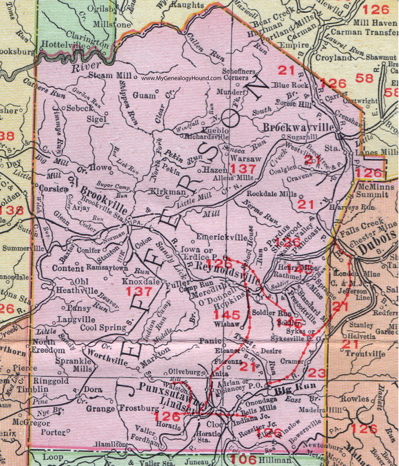
Jefferson County, Pennsylvania 1911 Map

Locations shown include: Adrian * Allens Mills * Anita * Arjay * Baxter * Beechtree * Bells Mills * Big Run * Blue Rock * Bowersville * Brockwayville (Brockway) * Brookville * Brookville Station * Camp Run * Carrier * Cloe * Coalglen (Coal Glen) * Coder * Colon * Conifer * Content * Cool Spring * Corsica * Cramer * Cravens * Crenshaw * Delancey P O * Desire * Dora * Elbel * Eleanor * Emerickville * Erdice P O * Fordham * Forest Hill * Florenza * Frostburg * Fuller * Glenn * Grange * Guam * Hamilton * Harveys Run * Hazen * Heathville * Henry Mine * Hopkins * Horatio * Horatio Station * Howe * Indiana Junction * Iowa * Kirkman * Knoxdale (Knox Dale) * Lanes Mills * Langville * Lindsey * Markton * McMinns Summit * Meredith * Munderf * Norman * O'Donnell * Ohl * Oliveburg * Onondaga * Pancoast * Panic * Pansy * Pardus * Pekin * Porter * Prescottville * Pueblo * Punxsutawney * Ramsaytown * Rathmel * Reynoldsville * Richardsville * Ringgold * Rockdale Mills * Rossiter Junction * Sandy Valley * Schoffners Corners * Sebeck * Sherwood * Sigel * Soldier * Soldier Run * Sprague Mine * Sprankle Mills * Standard Mine * Stanton * Steam Mill * Sugarhill (Sugar Hill) * Summerville * Sykes * Sykesville P O * Timblin * Valier * Walston * Warsaw * Winslow * Wishaw * Worthville * Wrestville *
This Jefferson County map is a portion of an 1911 Pennsylvania map by Rand McNally.
View additional Pennsylvania Maps here: Pennsylvania County Maps
County maps from other states can be viewed here: State County Maps
Use the links at the top right of this page to search or browse thousands of family biographies.