My Genealogy Hound
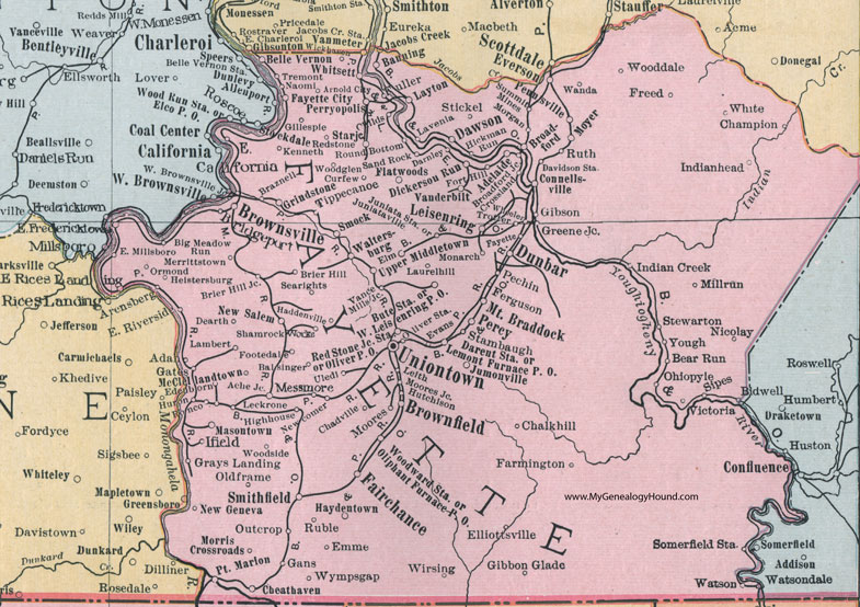
Fayette County, Pennsylvania 1911 Map

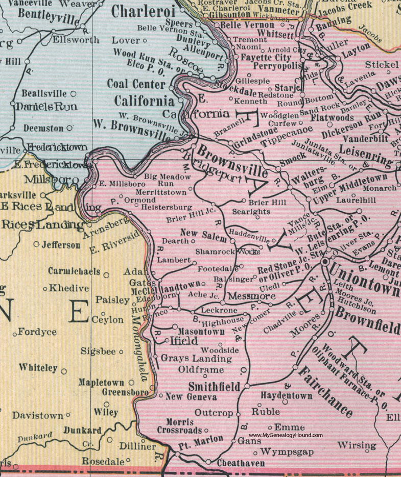
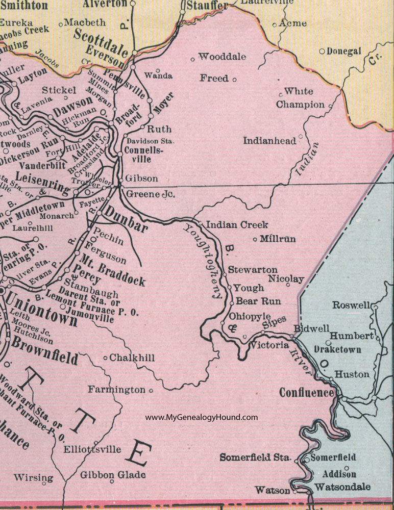
Locations shown include: Ache Junction * Adan * Adelaide * Arensberg * Arnold City * Balsinger * Banning * Bear Run * Belle Vernon * Bidwell * Big Meadow Run * Braznell * Bridgeport * Brier Hill * Brier Hill Junction * Broadford * Broadford Junction * Brownfield * Brownsville * Bute Station * Chadville * Chalkhill * Champion * Cheathaven * Connellsville * Crossland * Curfew * Darent Station * Darnley * Dawson * Davidson Station * Dearth * Dickerson Run * Dunbar * East Fredericktown * East Millsboro * East Rices Landing * East Riverside * Edenborn * Elliotsville * Elm * Emme * Evans * Everson * Fairchance * Farmington * Fayette * Fayette City * Ferguson * Flatwoods * Footedale * Fort Hill * Fredericktown * Freed * Fuller * Gans * Gates * Gibbon Glade * Gibson * Gillespie * Grays Landing * Greene Junction * Grindstone * Haddenville * Haydentown * Heistersburg * Hickman Run * Highouse * Huron * Hutchison * Ifield * Indian Creek * Indianhead (Indian Head) * Jumonville * Juniata Station * Juniataville * Kenneth * Lambert * Laurelhill (Laurel Hill) * Lavenia * Layton * Leckrone * Leisenring * Leith * Lemont Furnace P O * Masontown * McClellandtown * Merrittstown * Messmore * Millrun (Mill Run) * Monarch * Moores * Moores Junction * Morgan * Morris Crossroads * Mount Braddock * Moyer * Naomi * Newcomer * New Geneva * New Salem * Nicolay * Ohiopyle * Oldframe (Old Frame) * Oliphant Furnace P O * Oliver P O * Oliver Station * Ormond * Outcrop * Pechin * Pennsville * Percy * Perryopolis * Point Marion * Redstone * Red Stone Junction Station * Ronco * Round Bottom * Ruble * Ruth * Sand Rock * Searights * Shamrock Works * Sipes * Smithfield * Smock * Somerfield Station * Stambaugh * Star Junction * Stewarton * Stickel * Summit Mines * Tippecanoe * Tremont * Trotter * Uledi * Uniontown * Upper Middletown * Vance Mills Junction * Victoria * Waltersburg * Wanda * Watson * West Leisenring P O * Wheeler * White * Whitsett * Wickhaven * Wirsing * Wooddale * Woodglen * Woodside * Woodward Station * Wympsgap * Yough *
This Fayette County map is a portion of an 1911 Pennsylvania map by Rand McNally. See the enlarged map views below.

An enlarged view of western Fayette County, Pennsylvania on an 1911 map by Rand McNally.

An enlarged view of eastern Fayette County, Pennsylvania on an 1911 map by Rand McNally.
View additional Pennsylvania Maps here: Pennsylvania County Maps
County maps from other states can be viewed here: State County Maps
Use the links at the top right of this page to search or browse thousands of family biographies.