My Genealogy Hound
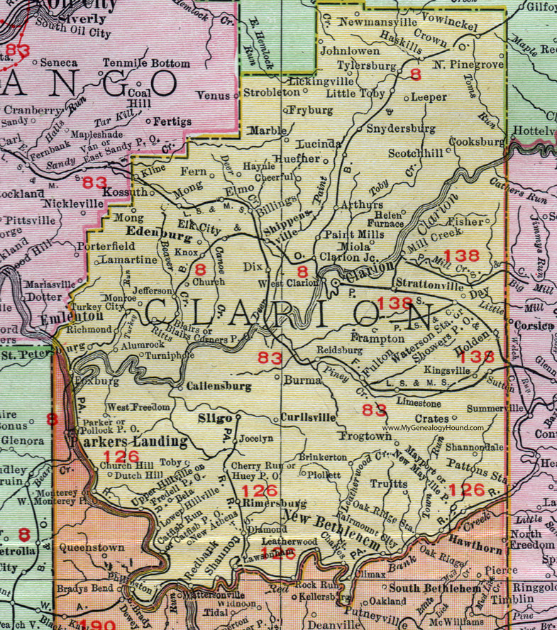
Clarion County, Pennsylvania 1911 Map

Locations shown include: Alumrock (Alum Rock) * Arthurs * Bela * Billings * Blairs * Blairs Corners P O * Brinkerton * Burma * Callensburg * Catfish P O * Catfish Run * Charles * Cheerful * Cherry Run * Church * Church Hill * Clarion * Clarion Junction * Crates * Crown * Curllsville * Day * Diamond * Dix * Dutch Hill * East Brady * Edenburg * Elk City * Elmo * Fairmount City * Fern * Fisher * Foxburg * Frampton * Fredell P O * Frogtown * Fryburg * Fulton * Haskills * Haynie * Helen Furnace * Holden * Huefner * Huey P O * Jefferson * Jocelyn * Johnlowen * Kingsville * Kline * Knox * Kossuth * Lamartine * Lawsonham * Leatherwood * Leeper * Lickingville * Limestone * Little Toby * Lower Hillville * Lucinda * Marble * Mayport * Mill Creek * Miola * Mong * Monroe * New Athens * New Bethlehem * Newmansville * New Mayville P O * North Pinegrove (North Pine Grove) * Oak Ridge Station * Paint Mills * Parker * Piollett * Pollock P O * Redbank * Reidsburg * Richmond * Rimersburg * Ritts * Saint Petersburg * Scotchhill (Scotch Hill) * Shannon * Shannondale * Shippensville (Shippenville) * Showers P O * Sligo * Snydersburg * Strattonville (Strattanville) * Strobleton * Sutton * Toby * Truitts * Turkey City * Turniphole (Turnip Hole) * Tylersburg * Upper Hillville * Vowinckel * Waterson Station * West Clarion * West Freedom *
This Clarion County map is a portion of an 1911 Pennsylvania map by Rand McNally.
View additional Pennsylvania Maps here: Pennsylvania County Maps
County maps from other states can be viewed here: State County Maps
Use the links at the top right of this page to search or browse thousands of family biographies.