My Genealogy Hound
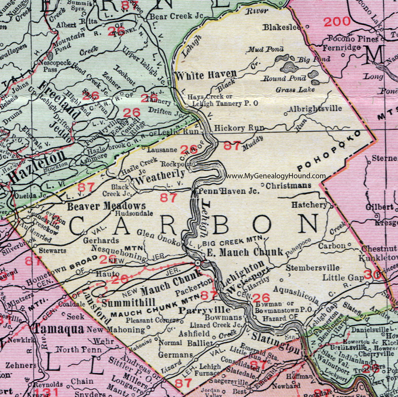
Carbon County, Pennsylvania 1911 Map

Locations shown include: Albrightsville * Aquashicola * Ashfield * Audenried * Balliet * Beaver Meadows * Black Creek Junction * Bowman * Bowmans * Bowmanstown P O * Carbon * Christmans * East Mauch Chunk * Gerhards * Germans * Glen Onoko * Harrity * Hatchery * Hauto * Hays Creek * Hazard * Hazle Creek Junction * Hickory Run * Hudsondale * Jeanesville * Lansford * Lausanne * Lehigh Gap * Lehigh Tannery P O * Lehighton * Leslie Run * Leviston * Little Gap * Lizard Creek Junction * Mauch Chunk * Nesquehoning * New Mahoning * Normal * Packerton * Palmerton * Parryville * Penn Haven Junction * Pleasant Corners * Rockport * Stembersville * Stewarts * Summithill (Summit Hill) * Tresckow * Weatherly * Weissport *
Note: The county seat of Carbon County, Mauch Chunk was renamed Jim Thorpe in 1953.
This Carbon County map is a portion of an 1911 Pennsylvania map by Rand McNally.
View additional Pennsylvania Maps here: Pennsylvania County Maps
County maps from other states can be viewed here: State County Maps
Use the links at the top right of this page to search or browse thousands of family biographies.