My Genealogy Hound
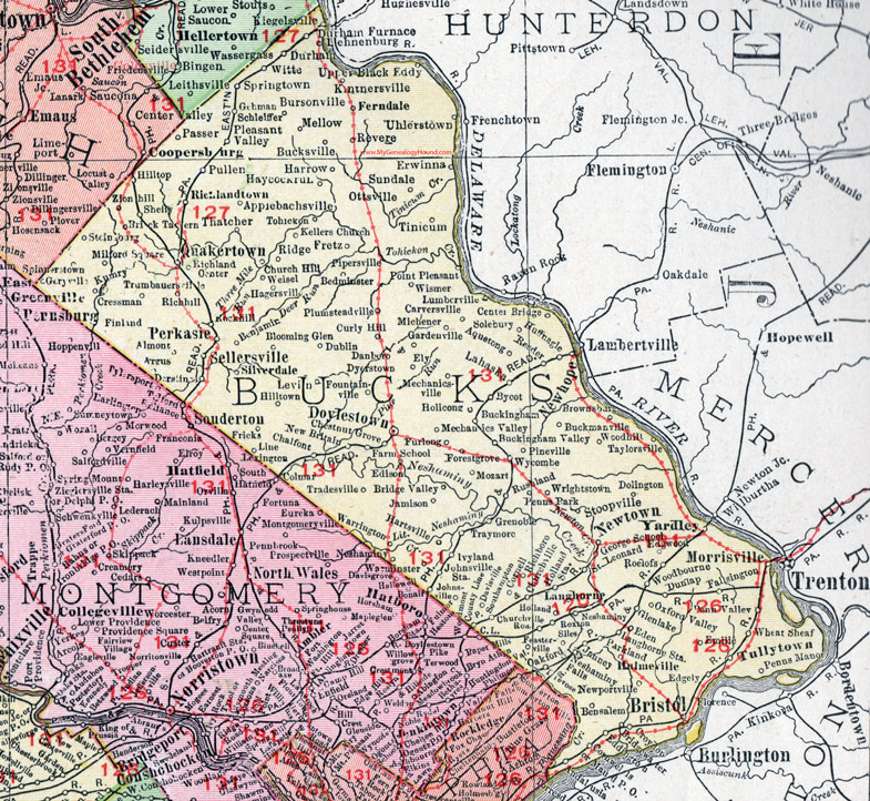
Bucks County, Pennsylvania 1911 Map

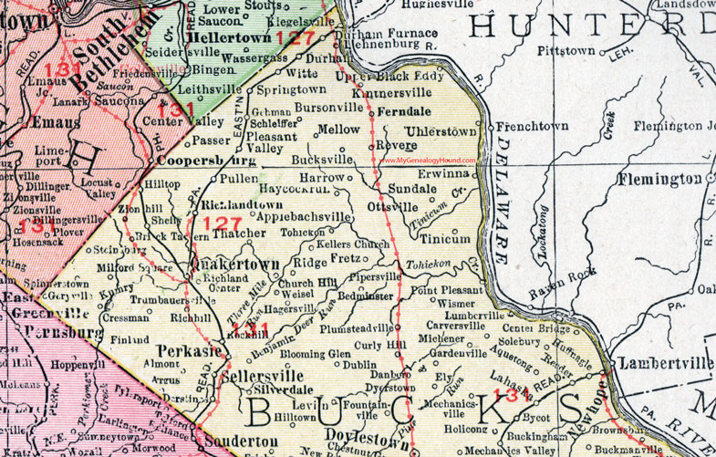
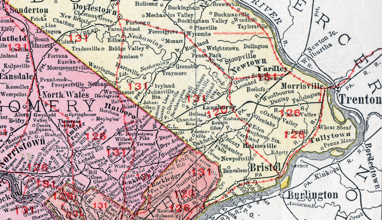
Locations shown include: Almont * Andalusia * Applebachsville * Aquetong * Argus * Bedminster * Benjamin * Bensalem * Blooming Glen * Brick Tavern * Bridge Valley * Bridgewater * Bristol * Brownsburg * Buckingham * Buckingham Valley * Buckmanville * Bucksville * Bursonville * Bycot * Carversville * Center Bridge * Central Bridge * Chalfont * Chestnut Grove * Church Hill * Churchville * Churchville Road * Cornell * Cornwells * Cressman * Croydon * Curly Hill * Danboro * Davisville * Derstines * Dolington * Doylestown * Dublin * Dunlap * Durham * Durham Furnace * Dyerstown * Eddington * Eden * Edgely * Edgewood * Edison * Ely * Emilie * Erwinna * Fallsington * Farm School * Feasterville * Ferndale * Finland * Forestgrove * Fountainville * Fredyffrin * Fretz * Fricks * Furlong * Gardenville * Gehman * George School * Geryville * Glenlake * Grenoble * Hagersville * Harrow * Hartsville * Haycockrun (Haycock Run) * Hilltop * Hilltown * Holicong * Holland * Holland Station * Huffnagle * Hulmeville * Ivyland * Jamison * Janney * Johnsville * Johnsville Station * Kellers Church * Kintnersville * Kumry * Lahaska * Langhorne * Langhorne Station * Lehnenburg * Levin * Line Lexington * Lumberville * Maud P O * Mechanics Valley * Mechanicsville * Mellow * Michener * Milford Square * Morrisville * Mozart * Neshaminy * Neshaminy Falls * New Britain * Newhope (New Hope) * Newportville * Newtown * Oakford * Ottsville * Oxford Valley * Parkland * Passer * Penn Valley * Penns Manor * Penns Park * Perkasie * Pineville * Pipersville * Pleasant Valley * Plumsteadville * Point Pleasant * Pullen * Quakertown * Reeder * Revere * Richboro * Richhill * Richland Center * Richlandtown * Ridge * Rockhill * Roelofs * Roxton * Rushland * Saint Leonard * Schlelffer * Sellersville * Shelly * Siles * Silverdale * Solebury * Southampton * Spinnerstown * Springtown * Steinsburg * Stoopville * Sundale * Taylorsville * Thatcher * Tinicum * Tohickon * Tradesville * Traymore * Trevose * Trumbauersville * Tullytown * Uhlerstown * Upper Black Eddy * Warrington * Weisel * Wheat Sheaf * Wismer * Witte * Woodbourne * Woodhill * Wrightstown * Wycombe * Yardley * Zionhill *
This Bucks County, Pennsylvania map is a portion of an 1911 Pennsylvania map by Rand McNally. See the enlarged map views below.

An enlarged view of northern Bucks County, Pennsylvania on an 1911 map by Rand McNally.

An enlarged view of southern Bucks County, Pennsylvania on an 1911 map by Rand McNally.
View additional Pennsylvania Maps here: Pennsylvania County Maps
County maps from other states can be viewed here: State County Maps
Use the links at the top right of this page to search or browse thousands of family biographies.