My Genealogy Hound
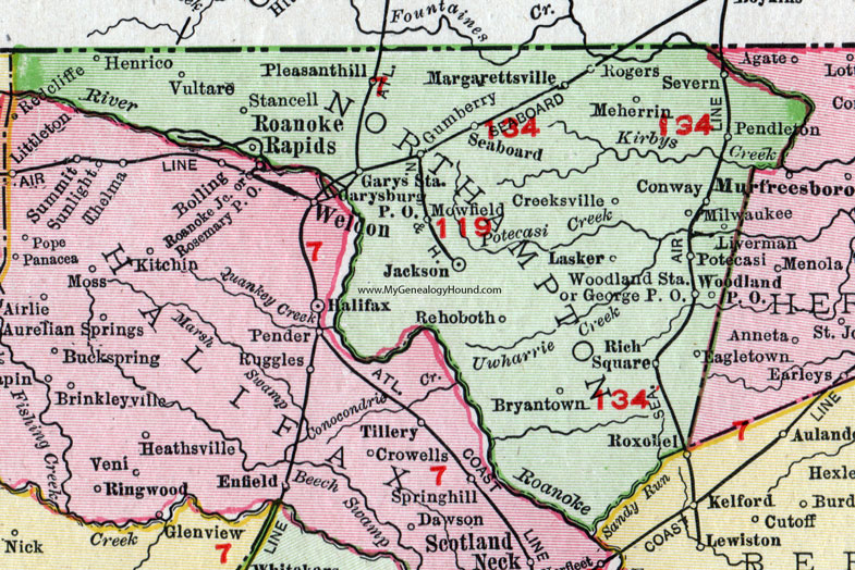
Northampton County, North Carolina, 1911 Map

Locations shown include: Bryantown, Conway, Creeksville, Eagletown, Garysburg P O, Garys Station, George P O, Gumberry, Henrico, Jackson, Lasker, Liverman, Margarettsville, Meherrin, Milwaukee, Mowfield, Pendleton, Pleasanthill (Pleasant Hill), Potecasi, Rehoboth, Rich Square, Roanoke Rapids, Rogers, Seaboard, Severn, Stancell, Vultare, Woodland P O, Woodland Station.
This Northampton County map is a portion of a 1911 North Carolina map by Rand McNally.
View additional North Carolina Maps here: North Carolina County Maps
County maps from other states can be viewed here: State County Maps
Use the links at the top right of this page to search or browse thousands of family biographies.