My Genealogy Hound
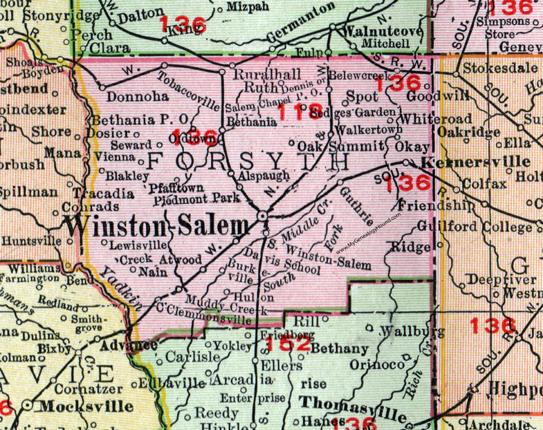
Forsyth County, North Carolina, 1911 Map

Locations shown include: Alspaugh, Atwood, Belewcreek (Belews Creek), Bethania, Bethania P O, Blakley, Burkeville, Clemmons (Clemmonsville), Creek, Davis School, Dennis, Donnoha (Donnaha), Dosier, Goodwill, Guthrie, Hulon, Kernersville, Lewisville, Muddy Creek, Nain, Oak Summit, Okay, Pfafftown, Piedmont Park, Ruralhall (Rural Hall), Ruth, Salem Church P O, Sedges Garden, Seward, South Winston-Salem, Spot, Tobaccoville, Vienna, Walkertown, Whiteroad, Winston-Salem.
This Forsyth County map is a portion of a 1911 North Carolina map by Rand McNally.
View additional North Carolina Maps here: North Carolina County Maps
County maps from other states can be viewed here: State County Maps
Use the links at the top right of this page to search or browse thousands of family biographies.