My Genealogy Hound
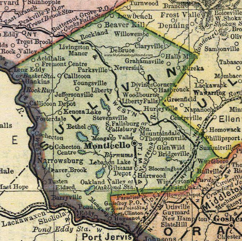
Sullivan County, New York 1892 Map

Locations shown include: Acidhalia * Barnums * Barryville * Basket Station * Beaver Brook * Beaver Kill * Bethel * Bloomingburgh * Bridgeville * Callicoon * Callicoon Depot * Centreville * Claryville * Cohecton * Cohecton Centre * DeBruce * Divine Corners * Eldred * Eureka * Fallsburg Station * Fosterdale * Fremont Centre * Gilmans Depot * Glen Wild * Grahamsville * Hall's Mills * Hankins * Hartwood * Hasbrouck * Hurleyville * Jeffersonville * Kenoza Lake * Lebanon Lake * Lewbeach * Liberty * Liberty Falls * Livingston Manor * Long Eddy * Monticello * Mongaup * Mongaup Valley * Mountaindale * Narrowsburg * Neversink * Oakland Station * Oakland Valley * Parksville * Phillipsport * Pond Eddy * Rockland * Rock Run * South Fallsburg * Stevensville * Summitville * Thompsonville * Tusten * Willowemoc * Winterton * Woodbourne * Wurtsboro * Youngsville *
This Sullivan County map is a portion of an 1892 New York map by Mathews-Northrup Co.
View additional New York Maps here: New York County Maps
County maps from other states can be viewed here: State County Maps
Use the links at the top right of this page to search or browse thousands of family biographies.