My Genealogy Hound
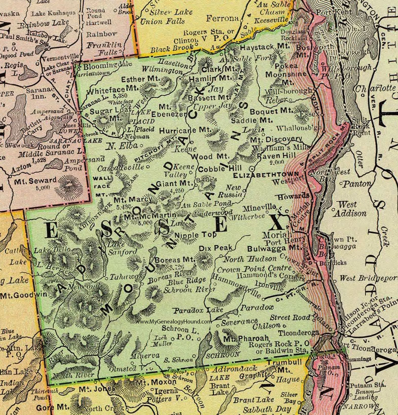
Essex County, New York 1897 Map

Locations shown include: Au Sable Forks * Baldwin Station * Beede's * Bloomingdale * Blue Ridge * Boreas River * Burdicks * Cascadeville * Chilson * Crown Point * Crown Point Centre * Delano * Douglass * Elizabethtown * Essex * Hammond's Corners * Hammondsville * Haselton * Ironville * Jay * Keene * Keene Valley * Keeseville * Lake Placid * Lewis * Loch Muller * Minerva * Mineville * Moriah * Moriah Centre * Newman * New Russia * North Elba * North Hudson * Olmstedville * Paradox * Port Henry * Raybrook * Reber * Rockland * Rogers Rock P O * Schroon * Schroon Lake P O * Schroon River * Severance * South Schroon * Street Road * Summervale * Ticonderoga * Tuhawas * Underwood * Upper Jay * Wadhams Mills * Westport * Whallonsburgh * Whiteface * Willsborough (Willsboro) * Willsborough Point * Willsborough Point P O * Wilmington * Witherbee *
This Essex County map is a portion of an 1897 New York map by Rand McNally.
View additional New York Maps here: New York County Maps
County maps from other states can be viewed here: State County Maps
Use the links at the top right of this page to search or browse thousands of family biographies.