My Genealogy Hound
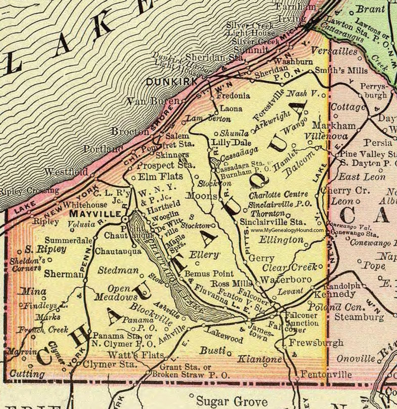
Chautauqua County, New York 1897 Map

Locations shown include: Arkwright * Ashville * Balcom * Bemus Point * Blockville * Brockton * Broken Straw P O * Burnham P O * Busti * Cassadaga * Cassadaga Station * Charlotte Centre * Chautauqua * Clear Creek * C. L. Railway Junction * Clymer * Clymer Station * Cutting * Dewittville * Dunkirk * Dunkirk Harbor Light House * Ellery * Ellington * Elm Flats * Falconer * Falconer Junction * Fentonville * Fentonville Station * Findley Lake * Fluvanna * Forestville * Fredonia * French Creek * Frewsburgh * Gerry * Grant Station * Hamlet * Hartfield * Jamestown * Kennedy * Kiantone * Lakewood * Lamberton * Laona * Levant * Lilly Dale * Maple Springs * Marks * Marvin * Mayville * Mina * Moons * Nashville * North Clymer P O * Open Meadows * Panama P O * Panama Station * Point Chautauqua * Poland Center * Pomfret Station * Portland * Prospect Station * Ripley * Ripley Crossing * Ross Mills * Salem * Sheldon's Corners * Sherman * Sheridan P O * Sheridan Station * Shumla * Silver Creek Light House * Silver Creek Summit * Sinclairville P O * Sinclairville Station * Skinners * Smith's Mills * South Ripley * Stedman * Stockton * Stow * Summerdale * Thornton * Van Buren * Villenova * Volusia * Wango * Washburn * Waterboro * Watt's Flats * Westfield * Whitehouse * W. N. Y. & P. Junction * Wooglin *
This Chautauqua County map is a portion of an 1897 New York map by Rand McNally.
View additional New York Maps here: New York County Maps
County maps from other states can be viewed here: State County Maps
Use the links at the top right of this page to search or browse thousands of family biographies.