My Genealogy Hound
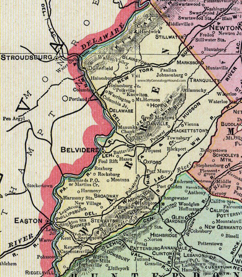
Warren County, New Jersey, 1905 Map

Locations shown include: Allamuchy, Anderson, Asbury, Beatyestown (Beattystown), Belvidere, Blairstown, Brainards P O, Bridgeville, Broadway, Broadway Station, Buttzville, Calno, Carpentersville, Columbia, Columbia Junction, Danville, Delaware, Dunnfield, Finesville, Foul Rift, Great Meadows, Hackettstown, Hainesburg, Hainesburg Junction, Hardwick, Harmony Station, Hazen, Hope, Johnsonburg, Kennedy, Kent, Knowlton, Lehigh Junction, Lopatcong, Manunka Chunk, Marksboro, Martins Crossing, Millbrook, Montana, Mount Hermon, New Hampton, New Village, Oxford, Paulina, Pequest, Phillipsburg, Pohatcong, Polkville, Port Golden, Port Murray, Riegelsville, Rockport, Rocksburg, Roxburg, Shimers, Springtown, Stewartsville, Stockton Station, Townsbury, Vail, Vienna, Vulcanite, Walnut Valley, Warren, Warrington, Washington.
This Warren County map is a portion of a 1905 New Jersey map by George F. Cram.
View additional New Jersey Maps here: New Jersey County Maps
County maps from other states can be viewed here: State County Maps
Use the links at the top right of this page to search or browse thousands of family biographies.