My Genealogy Hound
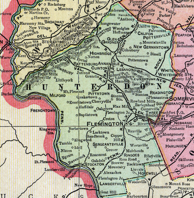
Hunterdon County, New Jersey, 1905 Map

Locations shown include: Alexauken, Annandale, Anthony, Asbury Station, Baptistown, Barbertown, Barleysheaf (Barley Sheaf), Bissell, Bloomsbury, Browne, Byram, Califon, Califon Station, Centerville, Cherryville, Clinton, Cloverhill, Cokesbury, Copper Hill, Croton, Everittstown, Fairmont, Flax Mill, Flemington, Flemington Junction, Glen Gardner, Goat Hill, Grandin, Grover, Hamden, Hampton, Hampton Junction, Highbridge (High Bridge), Hoffmans, Huffdale, Hughesville, Idell, Johnsons, Jutland, Kingwood, Lambertville, Landsdown, Lebanon, Linvale, Littleyork (Little York), Locktown, Milford, Mountainville, Mountairy (Mount Airy), Mount Pleasant, Muirheads, New Germantown, Nieces, Norton, Oakdale, Oakgrove (Oak Grove), Pattenburg, Pittstown, Pleasantrun (Pleasant Run), Potterstown, Pottersville, Prallsville, Quakertown, Ravenrock (Raven Rock), Readington, Reaville, Rileyville, Ringoes, Rocktown, Rosemont, Ross Road, Rowland Mills, Sandbrook, Sergeantsville, Sidney P O, Stanton, Stanton Station, Stockton, Sunnyside, Three Bridges, Tumble, Valley, Vernoy, Warren Paper Mills, Wertsville, West Portal, Whitehouse, Whitehouse Station, Woodglen.
This Hunterdon County map is a portion of a 1905 New Jersey map by George F. Cram.
View additional New Jersey Maps here: New Jersey County Maps
County maps from other states can be viewed here: State County Maps
Use the links at the top right of this page to search or browse thousands of family biographies.